


Rolta Geomatica Suite: An Integrated Software for Remote Sensing and Image Processing
Through a single integrated software system, the Rolta Geometica Suite helps turn imagery into answers and offers robust solutions for all types of desktop Geomatics.
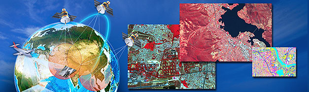
An integrated software for Remote Sensing and Image Processing, the Rolta Geomatica Suite can be used for conducting urban and utility mapping, change detection studies, and radiometric or atmospheric correction of images received from data agencies. The solution can also be used for Radarsat/Envisat data processing, helping identify the movement of elements like tanks or troops along sensitive border areas.
Features:
- State-of-the-art tools for geometric correction and image classification
- Cartographic map production
- Radar analysis & hyperspectral analysis
- Rolta Chip Manager, Rolta EASI, Rolta FLY and Rolta Modeler
- Rolta Ortho Engine
- Data visualization and editing
- Raster spatial analysis
Benefits:
- Single integrated entry point for all the Geomatics operations in the organization
- More than 150+ sensor support for all the industry standard sensors
- Advanced image processing algorithms ensuring the best analysis of image data
- Visual modeling & batch processing for faster turnaround of images
- Can be deployed in standalone mode or in network mode
- Project creation for a mosaic of a large number of image files
- Auto enhancement
- Strong algorithm support
Provides
- Accurate information
- Flexible communications
- Virtual reconnaissance
- Dynamic situational awareness
Improves
- Operational tempo
- Co-ordination
- Intelligence surveillance and Reconnaissance
- Navigation
- Logistics management
Reduces
- Operational procurement and support costs
- Administrative time by the automation of Simple functions
- Training costs
Simplifies
- Maintenance
- Support
- Customization
- Operations
