Rolta OnPoint™ – A fully featured web based GIS tool/viewer supporting business processes across diverse industries
Rolta OnPoint™ is a spatial integration application which allows its users to publish GIS data quickly and securely over the web, as well as connect to all internal & external data in real time
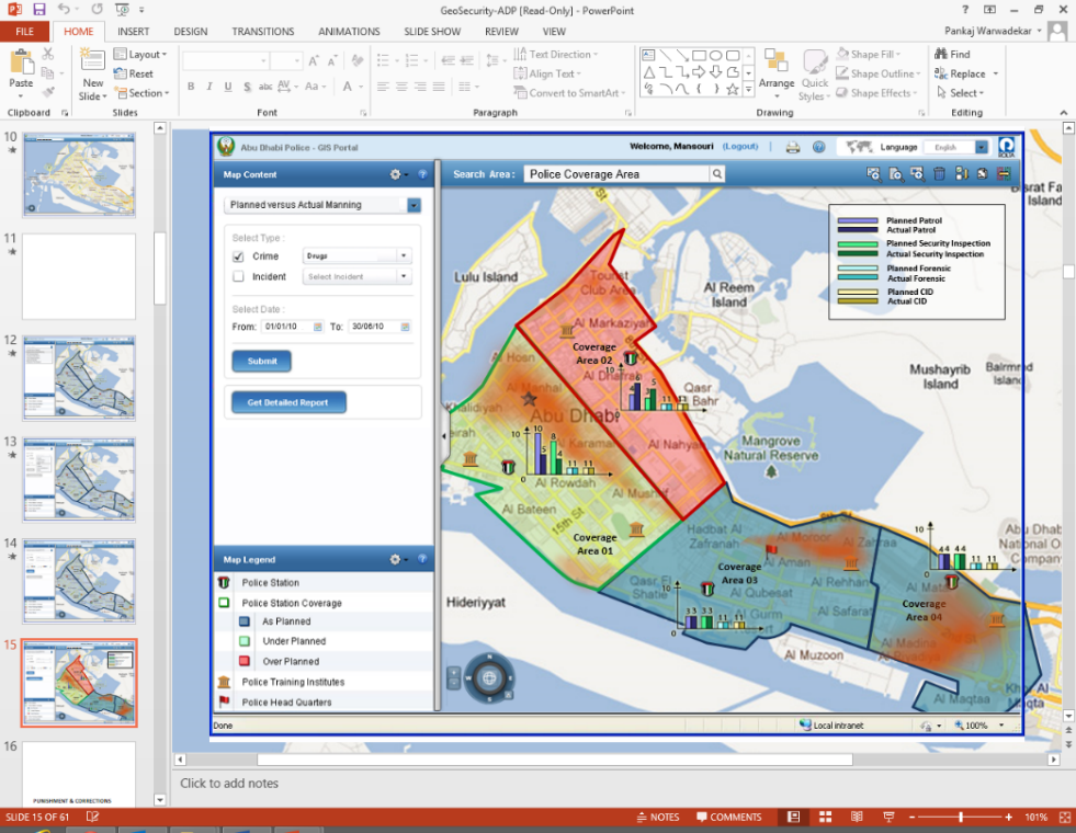
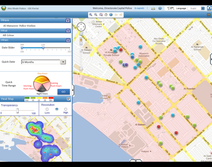
Geo-Spatial Fusion™ serves as the cornerstone of many operational and analytical functions. Rolta has built significant IP around this technology called Rolta OnPoint™. Rolta OnPoint™ is, provider agnostic, web based GIS tool/viewer. Rolta OnPoint™ is a full-featured spatial integration application that supports business processes across a diverse range of business functions and industries.
Using type and click operation in Rolta OnPoint™, clients can publish GIS data quickly and securely over the web, connecting to all data from inside and outside of the organization in real time. This data, in turn, can be easily disseminated via Internet and/or Intranet platforms, transforming web-GIS into a true enterprise solution.
Rolta OnPoint™ can also connect to industry standard databases such as Oracle, MS SQL Server, Teradata, Sybase, and any OBDC compliant data source via configurable web services.
Features
- Rapid deployment through Administrative Console
- Quick feature configurable with interfaces
- SOA based Web mapping services frameworks
- Multi layered security
- Advance web editing
- Rich Enterprise Data Integration
- Configurable search, spatial tools and geo-processing capability
- Multi lingual (130+ languages) support
- Seamless integration with Microsoft SharePoint Web Parts, Virtual Earth, Google & Bing Maps.
Benefits
- Rapid deployment and configurable features presentation reduces IT project cost
- Configurable web map services reduces the efforts and cost of enterprise integration
- Industry standard security compliance
- Interoperability with other systems seeking geospatial content and decision support systems
- Low cost of ownership