Rolta SDI – Distributed platform of network accessible spatial resources promoting discovery and collaboration
Rolta has always focused on developing solutions that contribute towards responsible and effective use of organizations Geospatial resources. One of the areas for effective use of Geospatial resources at multitude of scale is Spatial Data Infrastructure (SDI).
Rolta’s SDI™ is a powerful framework of technologies policies, people and arrangements that facilitate the creation, exchange and use of Geospatial resources across organizations and communities. As nodal agencies, government organizations are under constant pressure to make spatial data more accessible to other departments, organizations, professionals as well as industry. Users within and outside the government are under pressure to do more with less, and hence seek opportunities to leverage spatial data collection and analysis efforts already undertaken by others.
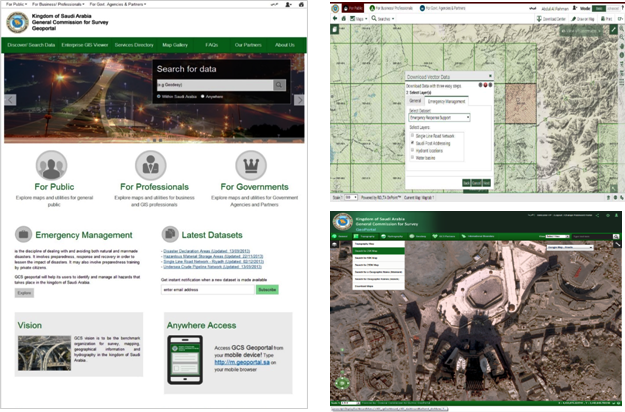
Rolta SDI™ is a distributed platform of network accessible spatial and non-spatial resources from multiple participating stakeholder organizations. The solution facilitates and supports the adoption of geospatial standards for data and applications across organizations and enables a common portal for publishers and users of spatial content to share spatial information, data, tools, and applications.
Key Features:
- Collaboration: Organizations can share their spatial and non-spatial data, applications, and tools on the SDI. The SDI™ solution enables agencies to share knowledge, resources, and domain specific data as grouped resources.
- Data Security: Publishers can choose to add data, web services, and applications and can control access to the data published.
- Create and publish new applications in minutes: Developers can search and use appropriate templates and tools from the plethora of ready to use maps and apps contributed by participating agencies. With SDI™, publishing a new spatial application is only few clicks away.
- Enhanced Map Viewer: Rolta SDI™ provides an interactive map with toolbox of advanced map analysis tools.
- Interactive Query Builder: The interactive query builder allows power users, familiar with the data, to build dynamic query expressions to optimize search results for applications and analysis.
- Content Catalogue: Provides a Gallery to access and view various published data as services along with Thumb view of the map through Registry Authoring Media.
Benefits
- Reduced cost of ownership: ROLTA SDI™ provides a common, shared repository of useful maps & services built by different organizations, thus reducing TCO of individual participating stakeholders.
- GIS For Everyone: GIS data and application are available over the Internet providing ease of access to spatial content to GIS professionals and non-professionals.
- Mix and match: Ability to create a brand new application using data published by one agency and tools provided by another.
- Reduced CAPEX: ROLTA SDI™ solution promotes sharing of infrastructure, spatial software, and licenses leading to reduced capital expenditures and cost of ownership.
- Improve accessibility: As the spatial content is available on the SDI, spatial data are accessible on the go: from a smart phone on the field to an office personal computer.
- Enhanced flexibility: Organizations can change applications and business logic as and when new spatial data and tools are available by participating agencies.


