Rolta Geo Environment™- Achieve greater geo-processing and analytics capabilities to diverse natural resource data and its related assets
Rolta Geo Environment™ provides geo enabled environment information and analytics capabilities. GeoEnvironment™ helps Organisations across the world to have geo-enabled enterprise resource planning tools to monitor over time and locations environmental resources and infrastructure.
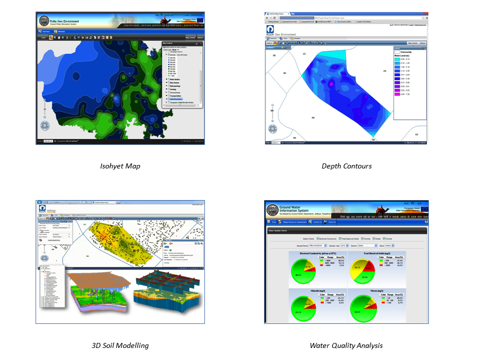
Rolta GeoEnvironment™ for soil offers geospatial enabled dashboards that make soil data available quickly and in an easy-to-read format. It allows users to analyse the soil on various qualitative and quantitative aspects, these include analysis of subsurface soil and water on various parameters like soil strength, its lithology, sulphate and chlorine and pH values.
Rolta GeoEnvironment™ for water offers geospatial enabled dashboards that make hydrological data available quickly and in an easy-to-read format. It allows users to analyse the water on various qualitative and quantitative aspects, these include analysis of subsurface water on various parameters like fitness for human consumption, sulphate and chlorine, water level, VES and VLF data and pH values.
The solution integrates with and supports industry standard platforms and integration interfaces.
Features:
- Support for Soil, Water and Air Analysis with BI integration.
- Extensible services component for geo-processing capability.
- Pattern and trend analysis, from diverse sources, including historical depiction on map.
- Provides dashboard for information monitoring.
- Provides multi-level visualizations for mission-critical conclusions.
- Enable publishing new GP Models.
- Defining custom threshold parameters for predictive assessment.
- Results can be saved as Geo/3D PDF
Key Value Proposition:
- Support for Soil, Water, and Air Analysis with BI integration.
- Extensible services component for geo-processing capability.
- Provides pattern and trend analysis, from diverse sources, including historical depiction on map
- Make environmental data available quickly in easy-to-read format in short time period.
- Enables efficient and effective decision support system to manage scare resources.
- Provide effective means to locate resource distribution and spread.
Benefits:
- Better Decision Making: Enable users to perform pattern and trend analysis from diverse sources, including historical depiction on map.
- Extensible and flexible: Allows geo-processing capability through services components.
- Unified view and productivity: Integrated water, air, soil and BI dashboards reduce time for analysis.


