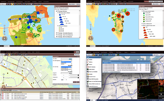
Rolta Geo Assets™- Integrated Geospatial and Business Systems for Asset Management
Rolta Geo Assets™ is a rich web based asset and workflow management product that provides a centralized view of the asset information collated from various systems enabling effective asset management and maintenance.
Rolta Geo Assets™ offers a framework for managing different aspects of asset as part of enterprise resource planning thus giving user the ability to spatially track asset investment and asset condition over time, for both an individual asset and network basis. The product enables better CAPEX planning, more proactive asset maintenance resulting in significant financial savings.
Features:
- Out-of-box integration with industry standard Asset Register and Geo Assets™ repository
- Provides powerful automated asset creation tools from CAD drawing, excel spread sheet, etc.
- Advance geospatial web editing tools to management assets creation, update and deletion.
- Ability to spatially track asset investment versus condition over time on individual asset level and network basis as well.
- Provides built in work flows and interfaces for Document Management, Works Management, Project Management, and Complaint Management System.
- Easy integration with GPS enabled mobile devices for field &/or mobile work force exact location intimation, dispatch and management
- Seamless integration with vendor neutral ERP and various Operational Systems for Utilities, Government or Transportation.
- Preconfigured spatial searches of assets by hierarchy or specific information.
- Preconfigured KPIs dashboard for monitoring.
Key Value Propositions:
- Geo-enabled EAM & DMS systems for effective asset lifecycle and workflow management.
- Automate asset creation from CAD drawing, or excel spread sheet.
- Spatially track asset investment versus condition over time.
- GIS mobility solutions for field team.
- Improve resource utilization, analysis, safety and asset integrity through an ability to create and represent work orders and notifications at their exact location on a GIS map.
Benefits:
- Unified view for better decision making: Enables users to capture, analyze, and display assets, locations, and work orders using interactive mapping interface.
- Improve Operational Efficiency: Improves efficiency with automated processes and self-service capabilities.
- Improve productivity: Reduces asset incident resolution time with accurate and timely intimation of physical asset location and other information thus improving health, safety and security. It significantly improves the tracking of work, accountability, and identify where resource shortages exist.
- Optimized expenditures on infrastructure assets: Helps to optimize expenditures on infrastructure assets by managing asset life cycle effectively, thus reducing inventory costs and regulating spending
- Better Asset Utilization: Enhances asset life and performance through analyzing key performance indicator dashboards. Also improves asset operations and maintenance through better communication system.


